INCONGRUENCE / ANNEXED MAP & LIST
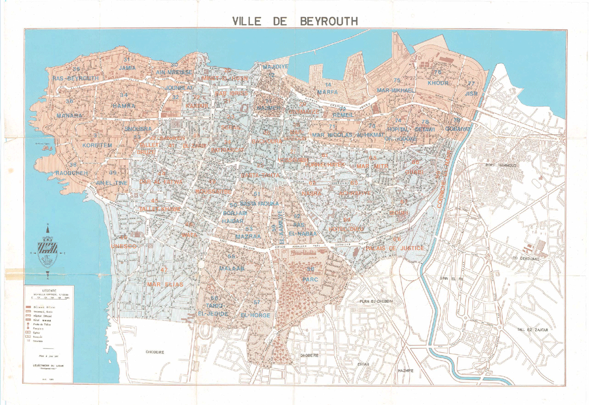
p73edl-a-m
Published in 1973 by the Electricité du Liban, The Guide of the City of Beirut includes a map (p73edl-a-m) in which municipal neighborhoods are readjusted and subdivided into sectors. The newly defined municipal zones are each ascribed a decimal value: tens, twenties, thirties, forties, up until the seventies. The sectors contained in each of these zones are numbered from 1 to 9 within that decimal – the twenties, for instance, count : 20, 21, 22, 23, 24, 25, 26, 27, 28, and 29.
The map, a totalizing homogenous representation, doesn’t immediately reveal what the numbered list (p73edl-a-l) does: while some decimal-zones are saturated from 1 to 9, the tens only count 11, 12 and 14; the 40s are missing their 3rd; the 50s their 4th, the sixties and seventies their 0s. Following no visible numerological, historical or geographical logic, the ten sectors 13, 15, 16, 17, 18, 19, 43, 54, 60 and 70 have been left out.
Is this imperfect order the product of a moment of intention or inattention?
Is it the condition or symptom of an inclination towards erosion and dispersion?
Is its invisible negative a necessary counterpoint to the material city?
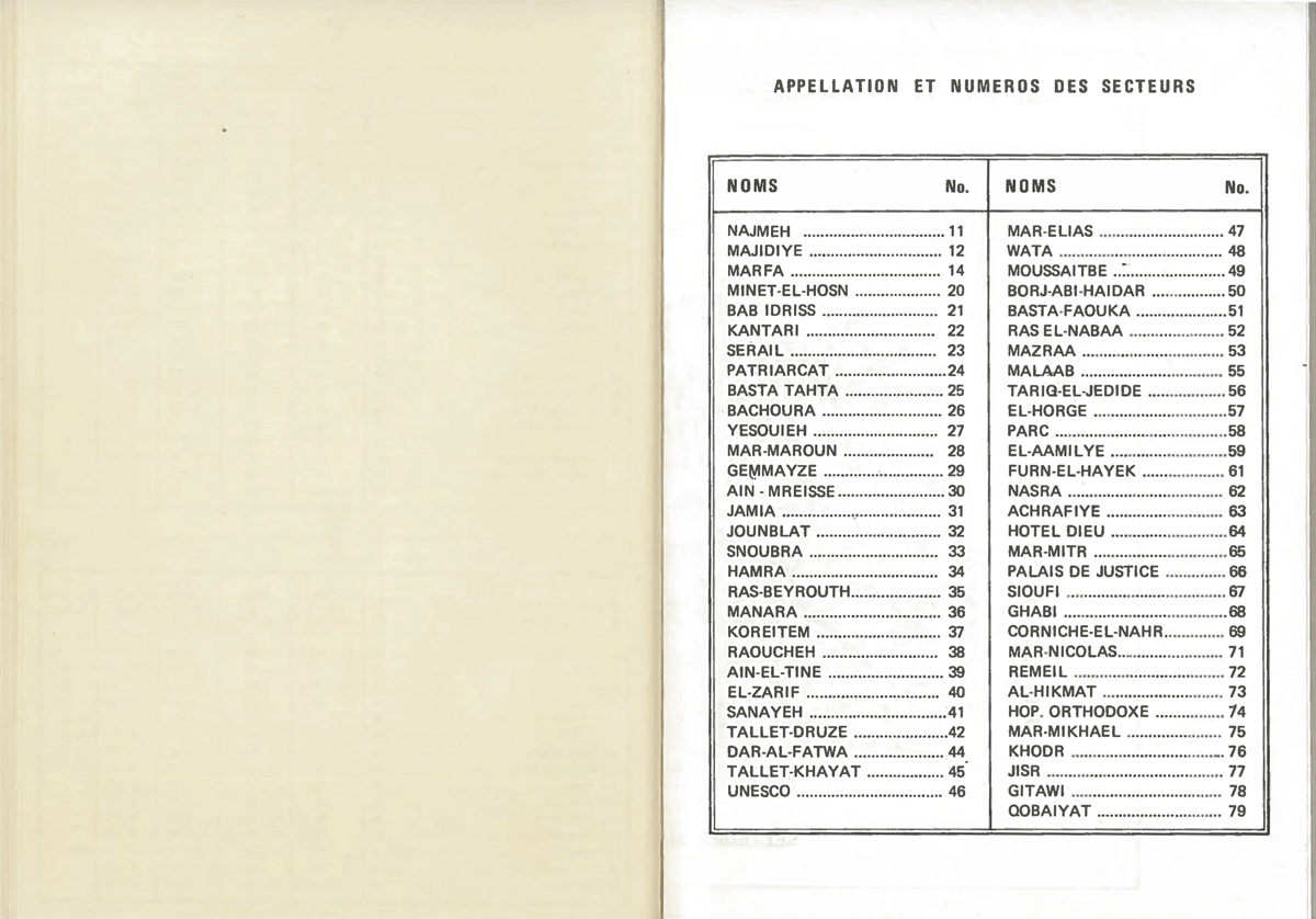

p73edl-a-l